Done Flippin' Y'all!
Some time has passed since our last blog. There is a lot to cover. Part of the reason it has taken so long to write is that the last 350 miles leading to the Southern terminus of the trail Mt. Springer, were perhaps some of the most trying miles of the trail both mentally and physically. We tackled the highest peaks on the whole trail traveling through the Smokies and the Natahalas. We battled injuries, as the miles started to take a toll on our bodies. We have narrowly avoided camps being raided by bears in the night, and we hiked directly through tropical storm Alberto. No doubt I will miss some things in this post, but here is what I remember from the last month.

There were a few towns that I did not want to fly-by as we hiked through the South. One of these being Hot Springs NC. This town was a definite highlight. It was sort of like a really laid back version of Damascus VA, which provided all the same amenities a hiker looks for but better. There was a tavern sat right on top of a creek with tons of local beer on tap and huge Texas toast burgers, a reasonably priced outfitters to replace broken gear, and a beautiful river to soak our feet in. Our SOBO trail companion “Turtle Man” caught wind of our whereabouts by reading our log book bread crumb trail and hiked extra big miles to catch up with us. At one point I believe we he was only 4 hours behind us, right on our heels. We were able to enjoy the town together, for the last time that we would catch each other until we run into him again up North. We drank PBR by the river underneath the bridge while we all soaked our feet. I’ve spent a lot of time trying to convince people that we are not becoming hoboes… it’s times like these where even I am not sure.
After Hot Springs we were headed to the much awaited Smoky Mountains National Park. This section of the trail felt like a real milestone to be hitting. When crossing NOBO hikers, all we had heard about for the last 500 miles was about everybody’s winter in the Smokies. We heard everything from people were getting heli-vacced from shelters that they had been trapped in from snow, to people that got dragged out of their hammocks by bears because they had seasoned themselves with coconut oil all over their arms before falling asleep. We were excited to see what all the fuss was about. The Smokies also presented some logistical challenges as they are the strictest park on the trail in terms of rules and regulations. Every thru hiker is to enter the park with a printed out copy of their permit which costs $20. Everybody must sleep in the shelters which are typically spaced either 10 to 20 miles apart. Their are “ridge runners” who enforce these rules all throughout the 70 miles of AT that go through the park. These rules present some challenges. I mentioned way earlier on that the “ultra light microwave” had not yet been invented. Well neither has the “ultra light printer”... needless to say it was a little annoying to have to print out our permits on paper. Also there are a fair amount of shelter closures throughout the smokies due to aggressive bear activity. Since you legally have to stay in the shelters this can severely shorten or lengthen your day.

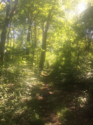
All that being said… The Smokies were by far some of the most beautiful parts of the trail we have done so far. Typically most people do the park in two stretches, stopping in Gatlinburg TN for a restock. Being seasoned SOBO travelers with hundreds of miles on our legs we decided to pack out food for the whole park. This meant the first day was rough. We had essentially a 15 mile climb up to our shelter. We also learned upon entering the park that it was incredibly dry. Therefore we did this climb with about 2 liters of water, that took 2 hours to gather. Once we made it up to the ridge though everything was worth while. The rest of the trail would take us winding throughout the tops of these beautiful mountains on ridge line for the rest of the way. Our first night we camped next to a lady who was responsible for one of the shelters being shut down. She had been cooking soup inside of her tent and managed to spill it all over her tent floor… really??? A bear smelled this and decided to spend the night perched on top of her tent happily chewing on it for the whole night. The lady was desperately trying to fight it, but everybody had given her the name “Bear Bait”, a well deserved trail name. The rest of the Smokies we really just a breeze after reaching altitude. There is not much to say other than it was a part of the trail that delivered the most consistently views the whole way through. Not worth trying to describe it any more than that.

Right, with the Smokies done we felt like we had really accomplished something now. We had booked our tickets from Atlanta to Philadelphia and we only needed to average about 14 miles a day to get there on time. Piece of cake. We took a couple of days of rest in Fontana Dam immediately after completing the park. We got back on trail and immediately had to take another day off in the Nantahala Outdoor Center (NOC), due to me injuring my quad and also the fact that the NOC was too nice to leave. The trail runs right through this place. It sits right on the Nantahala river and hits you with Adirondack chairs alongside the river as far as the eye can see. How could we leave? All of a sudden our 14 mile/day run into Atlanta had become 20 miles/day rain or shine run into Atlanta.

This is where the mental challenges really kicked in. We were feeling as there was not much else to look forward to in the South anymore. We hit the trail again after the NOC struggling to find the motivation to hike day in and out. Neither of our bodies were feeling a hundred percent as the miles were starting to wear on our bodies, and we were tackling the hardest terrain in the South. Despite the fact that we were feeling like trail veterans, we managed to forget that all of the highest peaks of the trail are in this region. The terrain was just beating us up. After one particularly tough day, we came dangerously close to committing to a hair-brained “slack packing” scheme, where we would pay someone way too much money to shuttle our bags 30 miles down the trail for us to make up some easy miles. Funnily enough this idea probably gave us the hope we needed to push through the painful day we were having. We woke up the next day feeling amazing after catching a stunning view from the top of Wayah Bald first thing in the morning. We scrapped the slack packing plan immediately, and were pumped up to hike strong to Springer Mountain.

Entering Georgia almost felt like when we began the trail in February. All of a sudden there were no more thru-hikers to be seen. We had passed by every single NOBO hiker bubble for the season. The only difference was that there were tons of small section hikers out occupying all campsites. Georgia is a heavily traveled section of the trail. It takes the brunt of every single hiker that thinks they are going to thru-hike the whole trail before they drop out. This makes for a much trashier trail which in effect makes for a more dangerous trail. We did more planning around bears in Georgia than we did in the Smokies. There were back to back shelters that had reports of nightly bear visits for the previous two weeks. No matter what way we cut it we would be sleeping in active bear territory every night. Nothing to do but to just push on. The week we crossed into Georgia it looked like it was going to rain every single day. We didn’t get rained on once until we inevitably hit the tropical storm we had been hiking towards. Tropical Storm Alberto had just got done hitting Florida before headed North ride along the Appalachians. These were by far the wettest days we have had on trail so far. Every bit of gear we owned was completely soaked, including our tent and sleeping bag. It was an intense couple days going head to head with Alberto, but in the end we came out on top. Summiting Springer Mountain, would have been underwhelming had we not hiked through a hurricane to get there,

but Amicalola Falls was the true Southern terminus in my mind. Walking alongside the falls we were incredibly proud of ourselves and the most exhausted we had ever been. At the beginning of the approach trail we asked a family to snap our photos at the entrance. They couldn't believe what we were telling them when we said we had just come 1147 miles from Pennsylvania. Their reactions were amusing but the more questions they asked the more I felt as if my knees were going to buckle underneath me and I would collapse before they took the photo! We were ready for a break and were excited to take a week off to spend time with family, do so much needed wedding planning, and rest our bones before tackling the Northern half of the trail.

Get it together Teatime, just ten more minutes and you can have all the ice cream sandwiches you could ever dream of. Just need to pose for one more shot...

There it is!

Comments
Post a Comment